Key to photos

UPPER ROW (left to right): Avon Suspension Bridge; the Avon River meets the Floating Harbor; red doorway; view SW across the Avon R.; self-explanatory; Wills Memorial Building (which houses the Geology Dept); a 'crescent'; a narrow boat on the Avon Canal
LOWER ROW (left to right): Terrace houses; Banksy street art; downtown Bristol; the Matthew (a replica of a boat that Cabot sailed across the Atlantic); the Grain Barge (my favorite pub); my new neighborhood (new photos to come once I move); rowing on the Floating Harbor

Sunday, April 28, 2013

Bristol street art


Imagine a city where graffiti wasn’t illegal, a city where everybody could draw whatever they liked. Where every street was awash with a million colours and little phrases. Where standing at a bus stop was never boring. A city that felt like a party where everyone was invited, not just the estate agents and barons of big business. Imagine a city like that and stop leaning against the wall - it’s wet.


So says Banksy, Bristol’s most famous (and anonymous) street artist. Banksy now has an international reputation and the city of Bristol has been converted from eradicating graffiti to preserving and encouraging it (within limits). The “naked man” painting is a case in point - it adorns a (rather inaccessible) wall along Park Street immediately across from the Bristol City Council (clearly an in-your-face move) and down the road from the Wills Memorial Bldg where I work (more about this building later). The naked man was painted in 2006 (and later defaced by another graffiti artist). The City Council threatened to paint over it but refrained when the public clamored to keep it. They have since changed their mind about street art, in large part because of an enormously popular exhibition at the Bristol Art Museum (right next to the Wills Building) entitled “Banksy vs. the Bristol Museum”. The Dorothy poster (“I don’t think we’re on canvas any more”) was one of the posters for this show (and one that I decided I needed to own). The “versus” says it all... amazingly, Banksy negotiated with the museum for free access to the museum, to convert as he saw fit.


Graffiti ultimately wins out over proper art because it becomes part of your city, it’s a tool. ‘I’ll meet you in that pub, you know, the one opposite the wall with a picture of a monkey holding a chainsaw.’ I mean, how much more useful can a painting be than that?

Bristol apparently has a long history of city vs. graffiti artists. In the 18th and 19th centuries, chalk was the offending medium. Chalking was criminalized in 1837 with passing of the Encroachment Act, with additional strengthening laws enacted in early 20th century, aimed at the militant women’s suffrage movement who chalked slogans on the pavement. But street art in Bristol extends well beyond graffiti. One example revolves around a statue of William III in Queen’s Square. It was built in early 18th century and, symbolically, William III is clothed in Roman warrior garb! Apparently the statue was draped in mourning cloth in 1795 as a protest against acts aimed at limiting free speech that were passed by the government of Pitt the younger, who suspended habeas corpus. And then during the reform riots of 1831, a French tri-colored hat placed on statue. Queens Square remains a gathering place for protests.  

Later the public art in the city was apparently driven by historic enmity between the Merchant Venturers, who lived in Georgian Clifton (still the high rent district of Bristol) and the Whig/Liberal industrialists (the Frys of chocolate fame and the tobacconists, the Wills) who lived in south Bristol. Communities to the south and north of harbor merged to form the city of Bristol around 1900. This merger provoked a competition for control of commemorative landscapes in the city.  As a result, Frys/Wills group commissioned a statue of the MP Edmund Burke in 1894, a Whig MP who is now remembered as the founder of modern conservatism. The Merchant Venturers promptly commissioned a statue of Edward Colston, which now stands close to that of Burke (although I don’t have a photo - his contemplative pose is not as amenable to decoration as Burke’s outstretched hand!). Because I didn't have a picture of the Colston statue, I have included some other street art photos, including my favorite piece that sprouted up near the train station for a few weeks this winter. It is called "Shoot and Leave" (by street artists Filthy Luker, Pedro Estrellas and Jak Hardpoint), with reference to the popular British book on punctuation, "Eats, Shoots and Leaves" [if you don't know this, look on Wikipedia for the story behind the title]

The Merchant Venturers then went on to erect Cabot’s tower in 1897 to mark the spirit of mercantile entrepreneurism in the form of a tribute to John Cabot (Giovanni Caboto), who sailed the Matthew to North America in 1497 (apparently there is also a Cabot’s tower in Newfoundland, where he landed). Cabot’s tower sits on top of Brandon Hill, which I traverse every morning when I walk to work. A couple of weeks ago I was greeted with the appearance of numerous “tree cozies” [a play on tea cozy, for those of you who are not British]. These form a particularly entertaining type of street art - are apparently constructed and installed by stealth knitting groups... they may also adorn lamp posts or guard rails or last year I saw an entire narrowboat that was covered in a knitted “cozy” (even the life ring was covered).


To finish the story, the southern industrialists retaliated several years later by building the Wills Memorial Building (home of the School of Earth Sciences), which is 100 ft taller than Cabot’s tower and much grander... [the history of Bristol street art was excerpted from Banksy: the Bristol Legacy  edited by Paul Gough]

 Other examples of impromptu street art include the "fake moon" that appeared in front of the Cathedral for four nights in a row as part of an art festival. It was described on line as "a perplexing apparition in the night sky. Rising slowly, an intense ball of light illuminates the city skyline, casting long shadows across the grass".


And then of course there is my local artist/sailor Rupert, shown below applying a stencil that he made for me with my boat's name... which is Aeolus, the wind god of the Aeolian Islands, which means, of course, that he is also a volcano god: the islands are all volcanic; the Greeks thought that volcanoes were places where the Earth's internal winds could escape.

And finally a random selection of street art, beginning with the 'sanctioned' graffiti street art overseen by the paint drip man (Pouring Paint  by Nick Walker:


Thursday, March 21, 2013

Skiing on the mid-Atlantic ridge... and other tales of Iceland in March

Iceland in March is not what you might expect... it IS an island, and Reykjavik is on the water, so the climate is maritime (although North Atlantic maritime). And I visited in early March, only a few weeks from today, the equinox, when technically everywhere has the same 12(ish) hour day. But what I learned in Iceland is that the long dawn and twilight hours of summer also occur in March, so that the days felt longer than the technical sunrise-sunset time. The biggest difference in daylight relative to the UK is that, during the winter, Iceland is on GMT so that the day is shifted substantially to later mornings and much later evenings.

The purpose of the trip was to work with collaborators at the University of Iceland. My graduate student Emma joined me after the first weekend (which I spent with my friends Siggi and Malla), as she is currently studying samples from the 2011 Grismvötn eruption (supplied to us by Siggi). So my stories are limited to the environs of Reykjavik. I´ll recount them mostly as vignettes (jottings from my notebook).


Maybe I’ll start with Reykjavik. I’ve always loved the colorful houses and roofs, but my summer visits had failed to impress upon me the startling backdrop provided by the Quaternary and late Tertiary manifestations of the mid-Atlantic ridge... during the winter they are nicely highlighted by snow and can seem startlingly close. The first set of pictures below doesn’t do them justice because I was more interested in capturing the sweep of the landscape as viewed from the tower of Hallgrimskirkja, the modern cathedral that overlooks the downtown.


You can get a somewhat better sense in the upper right photo below, taken across the lake that separates the downtown from the University. I also included a picture of my favorite basalt statue ... I think of it as the essence of a volcanologist (head in lava).


The houses in the older part of town are quite distinctive. You know by now that I like colored houses. But many of Reykjavik’s colored houses are made of corrugated iron. I’ve come to appreciate the practicality of this as a building material. Not only is Iceland challenged on the wood front, but also the combination of frequent wind and abundant flying grit provide the perfect recipe for sandblasting. Also challenging is the corrosive nature of the salt sea air, however, so I guess there is no perfect Icelandic building material.


Reykjavik is full of reminders of Viking ancestors, from the statue of Leifur Eiriksson in front of the Hallgrimskirkja to the statue of the first settler Ingolfur Arnarson in the city center, to the network of streets in the old town named for Norse gods, including the trickster god Loki. Although DNA evidence is showing that the Icelanders have a lot of Irish in them (the Vikings stopped off in Ireland en route to Iceland), and Siggi’s friend Gisli’s theory is that the reason the Icelanders actually wrote down the sagas (thereby preserving a lot of Norse history and culture) is that they inherited (or learned) the Irish art of story telling. Gisli should know, as he is an expert in the sagas, on the faculty at the University. He also organized a spectacular exhibit in a lovely old building in Reykjavik that features many of the original manuscripts with the sagas, manuscripts that have been gradually returned to Iceland from Denmark. Gisli gave Siggi and me a wonderful guided tour... when we reached the news reels recording the return of the first (and oldest) of the manuscripts in 1971, Siggi started looking for himself - apparently he was part of the Boy Scout color guard assembled at the docks to meet the Danish ship. 


The old manuscripts stand in contrast to one of the newest contributions from Denmark - the new modern music hall, designed by Ólafur Elíasson, a Danish-Icelandic artist who also designed the wonderful rainbow bridge on the art museum in Aarhus (see the January blog).


Now lest you think that the weather is always sunny in Iceland... we were also treated to a blizzard in the middle of the week... it was lovely! Swirling snow against the early morning sky turned into a full day of high winds and blowing snow. Emma and I were staying in a nice apartment owned by the Nordic Volcanological Institute... as we got ready to walk into the University, Emma, my British student, excitedly told me that she had never been in such a snow storm and that she had put on all her clothes for the walk (I think she said that she wore two layers of everything except for 5 layers on top and three on her head!). It was a bit of a cold walk, but only because of blowing snow on my unprotected face. However, being Iceland, most people were in at work and the lovely Askja building (home of the Earth Sciences... lower photos below) felt snug and cozy with light filtering through the snow piled on the sloping windows. The building even has its own little cafe, so we didn’t have to brave the snow to find lunch (on other days we went to the student union, which serves excellent and reasonably priced hot lunches, among other things like skyr, the Icelandic version of yogurt for which all visitors develop an addiction).


The snow lasted only a day but the wind lasted longer and transported a surprising (to me at least) amount of volcanic ash from the 2011 Grismvötn eruption over 200 km to Reykjavik, leaving a pronounced brown layer on the snow... in fact, the ash was a surprisingly persistent feature when the wind was blowing, causing a gray murk downwind and limiting SE views from the ski area (more about that below).


It was also fun to immerse in Iceland for a bit. As is evident from the photo above, the Askja building is a lovely place to spend time, and there are lots of friendly volcanologists to talk to. I’ve been trying (not particularly successfully) to learn a little Icelandic, and I had several chances for immersion. Let’s see, there was the play that I attended with Siggi, Malla, daughter Anna and her boyfriend Snorri - Anna’s twin brother was one of the stars of the play, which was Dr. Faustus by Gertrude Stein. In Icelandic. Luckily the acting, costumes and set were excellent, so it was enjoyable even though I didn’t understand anyone except the dog (who kept saying “Takk fyrir”, which means thank you!). I also watched an episode of Borgen, a Danish TV series that is popular in the UK (although I have yet to get started on it - I have borrowed DVDs to get caught up on another very popular Danish TV series called, ominously, The Killing - a detective series). So I watched a Danish TV show with Icelandic subtitles (Malla helped me to follow the story line). And then there was the Open Day at the University... my astronomer/glaciologist friend Snaevarr had brought his portable planetarium (which he usually takes around to schools). I attended one show (in Icelandic) and was so mesmerized that I went to two more (each one was different... planetarium shows have changed a lot since I was little - amazing what you can do with computers :)).

And then there were excursions out of Reykjavik... to see some small “rootless cones” on an older lava flow just south of Siggi and Malla’s house (they are now the site of quarries, just like the cinder cones in Oregon).


And of course, as advertised in the title, skiing on the mid-Atlantic ridge with Siggi and Malla. The ski area lies just south of Reykjavik on hyaloclastite ridges formed by subglacial eruptions during the last Ice Age. Not a lot of vertical relief but fun skiing and fabulous views (note the plume in the bottom right picture - from a big geothermal plant that provides power and hot water for Reykjavik). 

The ski trip was on my last full day in Iceland, and at the time I thought it was a suitable finale to a wonderful trip. BUT the day continued to bring surprises, from a nice dinner with Vala, a geochemist who taught for several years at Bristol and is now back in Iceland, to the walk back to our apartment under brilliantly clear skies... for the entire walk back Emma kept saying that she wanted to see the northern lights. I had checked both on-line and with Snaevarr the astronomer, who said that the chances were low. But Emma was persistent and sure enough, just before we were going to head inside they started up on the northern horizon...

The brilliantly clear skies held through until the next morning, which meant that during the early morning bus ride to the airport we were treated to a spectacular sunrise that filled half the horizon with dawn light. We then had a scenic flight across southern Iceland, with wonderful views of the active rift zone and the very active volcano Hekla (the elongate snow-covered mountain to the left of the photo... note the veil of Grismvötn ash still hovering at, I assume, the tropopause). So what a surprise it was to land at Gatwick airport in a snowstorm!


Wednesday, February 27, 2013

Enjoying winter - Bavarian style

Although we had very light snow flurries in Bristol all weekend, it was nothing compared with last week in Munich, where I was teaching at a workshop for a European training grant for graduate students in volcanology. From Bristol the easiest route is via Amsterdam (which always impresses me with its complete lack of topography as well as geometric canals). From there you fly south, toward the Alps. Most of the flight was above the clouds, but as we dipped down the first view was of a gray and white world. By the next evening it was snowing seriously... I must say that I enjoyed wandering through a snowy evening in the city.


Munich, like many European cities, is an interesting mixture of the new and the old. The geology department sits in the midst of several art museums (which also span from the new to old - in art as well as buildings!). It is located within an easy walk of the city center, with its towers (many of them clock-bearing), pastry shops (confiserie), designer shops, beer halls and a wonderful large ‘open’ market (with individual stands enclosed against the winter chill). I didn’t have adequate time to explore the shops, but they clearly sold everything from meat to fruit and vegetables to wonderful arrays of cheese to flowers to... not to mention the wide array of cafes. Unfortunately, I had escaped for only a limited exploration time so I did explore the market area as I might have; it was cold so I walked fast and instead indulged myself by purchasing a small paper cone of warm spiced nuts from a sidewalk vendor.


BUT the highlight of the week by far was our mid-week excursion to the foothills of the Alps, where we experienced “sledging”, Bavarian style. Now as a New Englander I grew up sledding on the hills of the local golf course, where the big excitement was aiming for the small wooden golf cart bridge across the creek. But the Bavarians take sledding to another level - now I see where the luge as a sport came from! Our sledging expedition was not to a backyard hill but to a ski area...

First some background. Bavarian sledges are lovely wooden sleds with curved front runners. The ones we rented had comfortable insulated seats... BUT no brakes, and no obvious mechanism for steering (in contrast to the good ol’ Flexible Fliers that we grew up with). So the first requirement was some on land instruction of sledging techniques  from one of the PhD students. Then we were aimed toward the chair lift (which we shared with the skiers) and sent up the hill.


From the chairlift I could gaze down on the little town we had just driven through, and enjoy misty views of the foothills. We gathered as a group at the top; the locals engaged in a snowball fight but most of us were feeling just a bit apprehensive about the downhill journey. However, one by one our group launched themselves down the toboggan-like track that wound down the hill. [Our German friends found the word ‘toboggan” highly amusing... according to Wikipedia the word originated in Canada]


As with everything, what looked a bit scary from above turned out to be a blast... but because I had brought my camera with me I pulled over part way down to take some photos. Betty (the Munich-based volcanologist who organized both the workshop and the play day) had pulled over to do the same, so the two of us enjoyed the range of sledging styles that our group exhibited - and the multi-lingual squeals and giggles - as our group negotiated their first sledging runs.


Everyone wanted a second try after the first round, so up we went again... most of us felt distinctly more in control the second time around. However there was one part of the run - that was preceded by a warning sign to slow down, although slowing down was not really an option because it was also quite icy just at the point - with large back-jolting bumps that I didn’t manage any better then second time than I had the first time. For that reason, several of us decided that two runs was probably enough... AND that gave us a bit of time to explore the village.


The village was almost too cute - that is, too stereotypically Bavarian, with elaborately decorated chalet-style buildings and Bavarian totem poles (my description, not theirs) and the village church and pastry shop (I had a cup of coffee and an almond pastry, my excuse being the calories I had burned up in the cold). The village was interesting because it was not particularly touristy (it was associated with only a small local ski area) and there appeared to be no attempt at zoning... guest houses intermixed with small businesses and cow sheds (or at least that was what the smell suggested!).

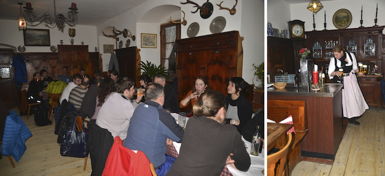
As it grew dark, we piled onto our big red bus and were driven to the next stop - a wonderful little Bavarian restaurant that was reserved just for us. Apparently it is Betty’s favorite place to eat after a day of skiing. The waitresses wore dirndls and served large glasses of weisbier (traditional Bavarian wheat beer). The food was warm and filling... particularly the dessert (luckily Betty ordered only one for our table to share... and we couldn’t finish it. Dessert consisted of a loaf of homebaked white bread smothered in a sort of thin warm custard sauce). Not surprisingly, the bus ride back to Munich was much quieter than the bus ride to the ski area earlier that day...


SO you Oregonians ... shall I import Bavarian sledges????  Maybe we can start a new craze. I must say, I could see it becoming addictive!!!!!!!!!

Sunday, January 20, 2013

Snow!

We had a proper snowstorm on Friday... I awoke to an already white neighborhood and snow-saturated air, so I rushed outside to record the event. “A really REALLY good day” is how it was described by a small child I pass in my snowy wandering around Bristol. Schools were closed and the parks sprouted snowmen and filled with kids and sleds as cars crawled and skidded along snowy streets. I took the long way into work to walk up a very snowy Avon Gorge, past the suspension bridge and Clifton green spaces en route to the department... I then left early and walked around the far side of the harbor, to take photos of colored houses in snow.

The irony is, that I spent the beginning of the week in snow, in Aarhus, Denmark, where
I attended a workshop on the impacts of volcanic eruptions on past societies. I went to Denmark with my historian friend Caroline (who also attended the conference) and her husband Richard... we decided that we might as well go a few days early and spend the weekend exploring the city. A Danish colleague in Bristol didn’t have much good to say about Aarhus, as it is not as lovely as Copenhagen, but I quite enjoyed it as a city. In fact, I’ve decided that I really like Scandanavia, in general. Aarhus is the largest city in Jutland. It’s on the east coast of the peninsula, and is clearly an important working port and business center.


The city is a nice size, and a mixture of the old and the new. The old takes the form of timber and plaster buildings with earth-tone colors reminiscent of Italy. The old parts of the city were made more charming by the snow that fell gently for much of our visit... and highlighted not only the little sidewalk snowplows that made the walk into the University possible, but also a variant with a large brush in front, to clear snow from rough cobblestone streets.

The new is a mixture of working city and modern design
I was particularly taken with the Aarhus art museum. The museum itself is a wonderful space, and happened to feature a special exhibit on Edward Munch... it was fascinating to see more of Munch than just The Scream, especially his interactions with the French impressionists. Although we did leave the exhibit with the overwhelming impression that he isn’t someone you’d want to spend much time with!  


But my favorite part of the museum by far was the ‘rainbow bridge’ on the roof of the building, which is a fantastically creative participatory art exhibit. People walking through the bridge create an ever-changing silhouette movie for spectators on the ground, while a walk through the ring of transparent colors is a unique and fascinating way to view the cityscape spread out in all directions.


Sunday, December 9, 2012

Light and water

I feel that life in the UK at this time of year is all about the light, the short days and low sun angle, when there is sun. I now have a theory that the intensity of Christmas (solstice) celebrations is directly proportional to latitude, although I admit that I have only a few data points! But here Christmas lights (mostly blue, for some reason) appeared in the city in early November, along with displays in the shops. Of the lights I’ve seen, those in Bath, however, are the most elegant (as well they should be). Bath also hosts a holiday market in the center of town - I want to go back to explore someday this week... and to taste the roasted chestnuts that fill the frosty air with a wonderful smell.

Ads for booking Christmas parties at pubs and restaurants make their appearance in September. Which illustrates the importance of the Christmas party as a cultural icon. And I’ve been invited to several. The sailing club Christmas party was on Dec 1, at a pub near me called the Rose of Denmark.

[historic note - the pub is named for Alexandra of Denmark, who was married to Albert Edward, Queen Victoria’s son, and was thus Princess of Wales... for a long time, given that Victoria’s longevity was similar to that of the current queen, thus Albert was in the same position as Prince Charles! But he did finally gain the throne in 1901, at which point her official title became, apparently, queen-empress consort to King Edward VII]
 
The volcanology group Christmas party is on Wednesday, at a pub called the Eldon. The department Christmas party is on Friday, in the department. And then on Saturday the sailing club is holding its “Mince Pie race” - I’ve volunteered my house as a place to heat up mince pies and mulled cider after the race ... it’s definitely getting sufficiently cold that no one feels like hanging around outside the pub after an afternoon on the water! There are a few more Christmas parties next week, but by then I will be back in Eugene.


One benefit of the low light, however, is that it provides nice illumination for photography. I thought I’d merge photos and accounts of a few different short trips/walks from the past month + (I’m afraid it’s been a very long time since the last blog!  Oops). 

Let’s see, the farthest afield I’ve been in the UK has been Durham, a picturesque little town in Northumberland, in the northeast, just south of Newcastle. I went there to give a seminar (my usual excuse for traveling around the country), and had an enjoyable day talking to people in the department, and then the next morning to myself, for a wander around town. It was an intensely clear and frosty morning - perfect for seeing Durham’s famed cathedral and castle. The cathedral and castle together occupy a narrow peninsula created by a big meander in the River Wear. 


According to the cathedral website, it is not only an icon of the north but also one of the UK’s best loved buildings... and, together with the castle, is one of the UK’s first World Heritage sites. The cathedral is Norman in style, built during the 11th and 12th centuries. The cathedral was built as a shrine for St. Cuthbert, the patron saint of northern England (he was most famously, at least for me, a Bishop of Lindisfarne, the “holy island” that lies just off the Northumberland coast).


The castle was constructed shortly after the Norman conquest to provide protection against invaders from the north. It was then the Bishop’s palace until being taken over by the University, where it is now a residence hall. I was too early for a tour of the castle, but photos in a brochure that I bought suggest that the resident students have a truly Harry Potter-esque experience, as the castle has a Great Hall that looks remarkably like the hall at Hogwarts.


I’ve managed only a few excursions closer to home recently - too much time spent stressing about proposals and the like. BUT after pushing the “submit” button on a proposal on Tuesday morning, I decided to take advantage of clear skies and revisit one of my favorite walks along the canal that runs between Bradford-on-Avon and Bath (about 9 miles... a walk that I last did with niece Susie and her friend Eric over a year ago). When we did the the walk it was autumn... last week it was definitely winter, with cold air, leafless trees, the dried remnants of vegetation and the low sun often unable to illuminate the valley. 

The canal was constructed for transport of coal... my time here has made me appreciate how difficult transport was prior to modern roads and rail. Which is why the coasts and offshore islands were heavily populated - transport by boat was relatively easy, and islands and narrow bays are easily defended. The canal was the next step - it parallels the river but is carefully graded for long horizontal stretches connected by locks, such that the canal crosses the river on a high bridge in two places between Bradford-on-Avon and Bath. The canals, however,ceased to be used with the construction of the railways, and then the highways; both the railway and the highway parallel the canal and the river along this part of the Avon.


Once a working canal, it now hosts a community of river denizens in narrow boats - I was surprised at how many there were, permanent homes for the mobile narrow boat community. On a chilly Tuesday morning they were the only people I saw along the stretches of canal between the small villages along the route. Close to the villages there were other runners and walkers taking advantage of the clear skies. I love the stillness of the water and mirrored reflections of the narrow boats and vegetation alike. 


The last part of the walk into Bath isn’t quite so interesting, but Bath itself is always lovely. I try to take a slightly different route into the city each time - this time I happened on the house that Jane Austen lived in from 1801-1805. The house itself is modest, but it has a great location across the street from Bath’s public gardens, and just around the corner from the much more upscale Great Poultney Street...

Odd to think that Jane Austen was living in Bath just as the Somerset Coal Canal was being constructed. Which leads to the last story of the blog. Another person living near Bath at the same time is someone who is famously (in geologic circles) associated with the Somerset Coal Canal - William Smith, author of the “map that changed the world” (the first geologic map, one copy of which resides in the tea room in our department). Apparently the first draft of his map was actually completed in 1801 (the same year that Jane Austen moved to Bath), although he did not publish the final version until 1815. And back in October I went on a William Smith walk with Jon Blundy and his daughter Lillian. 


Only I didn’t know that it was a William Smith walk when we started out... Jon just told me that I’d enjoy it, and that there would be some surprises along the walk (he also told me to be prepared for mud, which is true for many walks in the area).  We started at a tiny village called South Stoke, just a few miles south of Bath, and then walked east toward Monkton Combe [“combe” means valley in old English, “Monkton” refers to the fact that it was once owned by the monks of Bath Abbey]. A lovely day with perfect puffy white clouds floating over the Alice Through the Looking Glass chessboard landscape of this part of the world.

The walk followed a leafy and now abandoned section of the coal canal and included not only the usual pub stop for lunch (in a walled garden) but also a conveniently placed tire swing. We then popped out in Tucking Mill (in Monkton Combe), where William Smith lived for many years, while he was working on his geologic map. It's actually a sad story... the map was published in 1815. By 1819 he was in debtor's prison, and although he did manage to get out, he never quite recovered, and never returned to Tucking Mill or the Bath region.

And so back to a gray December morning on the harbor. Although I can’t complain, as the past week has been mostly clear and on a few days I’ve been treated to beautiful sunrises ... it’s amazing how far the sun has moved south around the horizon, so that to properly appreciate the sunrise I need to walk along the harbor toward the center of town.